As I travel around the country speaking at industry meetings, I need Google Maps to get me around unfamiliar cities and towns. It’s amazing how well the application works and can route me around heavy traffic and through the rural countryside. I don’t know what I would do without it, and I can’t imagine going back to Rand McNally paper maps.

I also love looking at the location’s street view so I know what the building looks like and what entrance I should be using. It saves me a ton of time.
Another great app is Google Earth. It can take you anywhere on the globe and let you zoom in on an area and see it in 3D, and it connects directly with Google Maps so you can see street views as well.
Have you checked out your farm on Google Maps and Google Earth? How does it look? What can people see?
Check out this video to see how Google Maps and Google Earth were created and how they are updated.
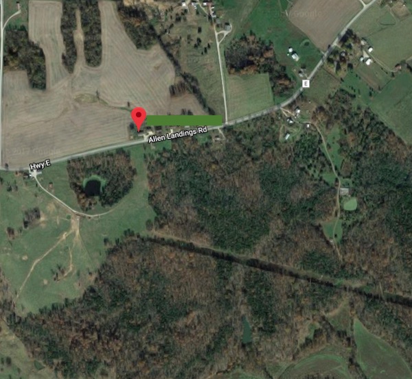
I’ve checked out my brother’s beef farm in rural Missouri, and I can see it’s been a few years since it has been photographed. It is missing the house being built and there are no cows visible, so it must have been taken when he was between herds.
Google Maps and Google Earth can pick up things that you might not want people to see, and sometimes you can have those things blurred out (if you can prove that it’s important people not see those things).
With Google Maps, you can blur faces, license plate numbers, and your house if you need to. With Google Earth, you can report issues with what it is showing. I understand your need for privacy, but do you know that if you have something blurred out, it can’t be reversed?
Here’s how to do it:
Report A Problem to Google Maps on a computer:
- Go to Google Maps and enter your street address.
- Go to the street view by clicking the lower “person” icon at the bottom right.
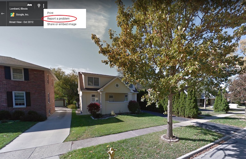
- At the top right, next to the address, click on the three dots.
- Click “Report a problem” and fill out the form.
- It may take up to a couple of weeks for the images to be blurred or to receive feedback from Google.

You can provide feedback about your property to Google Earth. I’ve only seen it blur out military operations and/or government buildings, so I don’t know if it will blur out a farm or not.
Give feedback to Google Earth:
- Go to Google Earth and enter your street address.
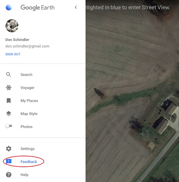
- If you want to report a problem, click on the “hamburger” three-line menu on the top right.
- In the menu, click on the feedback item.
- Fill out the form about the issue.

There’s also a form on Google for Legal Review if you want to use that to try and let them know you need something to be removed from their Google applications.
If you need help with what you’ve found on your Google Maps/Google Earth about your farm, feel free to reach out to your local checkoff or you can contact me at don.schindler@dairy.org.


